Site Recording
26 November 2008
By Kelly Bumpass
The shipwreck site we are recording was encountered by a local Ste. Marie diver. As it was very near the area of the previously recorded "copper site" it was thought to be associated and was made known to our local dive contacts and reported to us. The vessel remains are a complement to our earlier work in 1999 and 2004. Not only is there copper sheathing and ballast, but there is ship structure, cannon and other artifactual materials that will be analyzed for their temporal context as evidence of the Serapis.

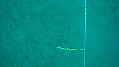
Example of baseline, prior to shooting photomosaic.
To accurately record the archaeological site, which lies between 60-80ft below the harbor surface we are careful and as thorough as possible in planning each dive. The depth is limiting our working times so we are very conservative with the time spent underwater under no-decompression limits. There is sometimes a tendency to become so focused on recording that time can slip away. A diver does not want to suddenly become aware of his low air supply, especially on this side of the world.
We are using standard underwater archeological techniques to record the site, the simple but basic off-set measurement. Tapes with standard English measurements are being used on the baseline and the transects are pulled using compass headings taken at 90 degree angles to the baseline. Each archeologist has a given set of tasks on a daily basis. Measurements are written on mylar sheets taped to slates and these are examined and recorded onto a site map on a nightly basis. Discrepancies in measurements and potential areas of concern are listed each night and given to divers in the morning to re-measure or to simply recheck. This system allows the most control over recording the site.
At present we have observed that the site contains ten cannon, brick and lead ingot ballast, and apparent runs of copper bottom sheathing known to have covered the underwater portions of the hull of the Serapis. These features have been mapped on a preliminary site plan. A coral mass covers portions of the site and excavation is not a potential option under the current archaeological recording program. That will be saved for future field seasons. The dimensions found closely correspond with the known Serapis measurements, so there is a mounting excitement among crew that we are recording the ship we have been looking for.
Please feel free to contact us at mua@keimaps.com with any comments, questions, or suggestions during the weeks to come.
Return to Project Journal home page.


