

UNESCO Training Project Journal
2 April 2008
By Kasthuri Arachchilage Anusha Kasthuri

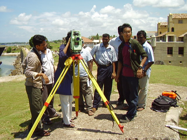
Nerina operating the Total Station. Large View (Photo courtesy of the Central Cultural Fund).
Mapping the Galle Fort Ramparts
Team 1 participated in the Total Station workshop at the Galle Ancient Fort Rampart. Mr. Tamura San from Japan and his assistant Lalinda brought their 'Total Station' equipment all the way from Anuradhapura, from the UNESCO Central Cultural Fund Jetavanaya Project. The Total Station was set up in the middle and two reflectors were set up to take fore-sight and back-sight measurements. They demonstrated how to take distance and angular measurements between the two points. We then started by fixing a base line. The line was fixed by making use of two Mean Sea Level bench marks on the ramparts of Galle Fort. This was followed by measuring other points across a section of the rampart walls.
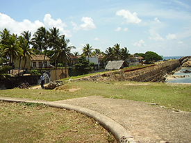
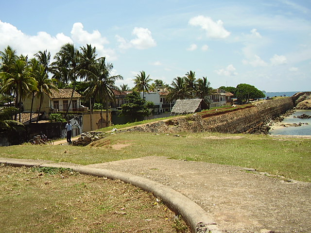
The Galle Fort Ramparts. Large View (Photo courtesy of the Central Cultural Fund).
Though we followed the operation of the equipment easily, the calculation and data analysis during the latter part of the workshop was hard work. Being out in the sun on the ramparts created a very difficult situation in which to collect measurements. The medal goes, however, to Tamura San (from Japan) who gave us this demonstration in Sinhalese! Thank you very much to Tamura San for doing a big job in training us.
Comments, questions, or suggestions?
For field school related issues please contact: amer.khan@flinders.edu.au
For website related issues please contact:
mua@keimaps.com
Return to Project Journal home page.