ECU's 2006 Fall Field School
Project Journal
16 October 2006
By Michelle Damian

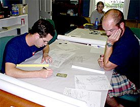
Adam and Joe transpose mylars onto the site map.
After the initial clean-up and organizational concerns that Amy mentioned last week, we have now settled into more of a routine as we tackle the various tasks at hand. In order to complete the conjectured construction, rigging, mast, and deck plan, we first need to have a map of the site as it exists today. From that, in conjunction with historical research, we will (hopefully!) be able to extrapolate enough information to create those drawings.
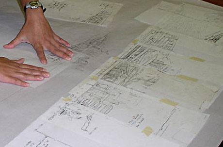
Michelle lines up the mylar on the site map.
In Calvin’s entry (week 1) there is a photo of a mosaic of mylars with our site scale drawings. Our next step is to take those mylars and see exactly how each section is matching up with the adjacent ones, making any necessary corrections as we go (a few crew members are heading back to the site to check some questionable points). We lay the mylars down under a sheet of graph paper to transpose them in pencil into a more cohesive site plan. Once that is complete, we’ll lay another large sheet of mylar over the graph paper and ink in the entire site map for a finished product. Right now we’re still transposing the mylars onto graph paper… but it’s starting to look like a shipwreck! In the meantime, we’re also working on the finishing touches for the shoreline maps for both site A and site B.
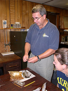
Dr Brad Rodgers shows how to remove concretions from an artifact before conserving it.
Last week Amy mentioned that we’ve all been assigned various tasks to round out our knowledge of this vessel. I worked in museums before coming to ECU, and brick-and-mortar museum folks are notorious for liking “Stuff” – the objects, the artifacts, the tangible remnants of history. So I’m actually pretty happy to be the one who will be recording and researching the various artifacts that we brought up from Site B. Last week several of us separated out the more unusual or representative artifacts, and the rest will be returned to the wreck site. This dovetails nicely with my Conservation class, taught by Dr. Brad Rodgers. He will work with us to teach us how to ensure that the artifacts do not suffer further deterioration as we dry them out and preserve them. Though that part will be a group effort (thanks to all of my classmates in Conservation!), I’ll also be responsible for photographing and possibly drawing some of the artifacts, as well as researching as much as I can about each object. A simple brass tack tells us that this ship was at one point a seagoing vessel, since those fasteners were used to secure hull sheathing in open waters. Determining when a particular style of square nail was used will help us pin down when the wreck was actually built. And of course I’m looking forward to examining those marbles in further detail – maybe I’ll be able to find out if it was indeed a sailor’s way of whiling away the time or if some child just tossed it into the river one day long after the ship had sunk.
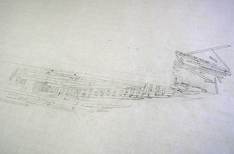
The site plan as of 13 October 2006.
There is a lot yet to do… and we’ll use all of this information to unlock the stories that the Washington Park vessel is waiting to tell us.
For more information you can visit the ECU website at:
http://www.ecu.edu/maritime/index.htm
Return to Project Journal home page.

