
- MUA Home
- All Project Journals
-
- Introduction
- 4-7 Feb 2008
- 9 Feb 2008
- 10 Feb 2008
- 11 Feb 2008
- 15 Feb 2008
- 24 Feb 2008
-
- Crew Page
- Flinders 2008 Field School Information
- Maritime Archaeology Postgraduate Programs
- Flinders Newsletter
- Flinders U. Program
-
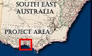
- The top banner of this page is made from two maps drawn and engraved By J. Rapkin, H. Warren, J. Rogers, J. & F. Tallis. The maritime scene depicts Melbourne, Australia on Port Phillip Bay. This year's field school takes place across the bay near the town of Portarlington. The maps were published in The Illustrated Atlas, And Modern History Of The World Geographical, Political, Commercial & Statistical, Edited By R. Montgomery Martin, Esq in 1851. Both maps are provided courtesy The David Rumsey Map Collection.


in Underwater Archaeology
9 February 2008
By Matt Carter and Rhonda Steel
After a great few days using the survey techniques we had been rigorously taught, the red team headed back to Indented Head to finish our survey. The initial survey involved walking and swimlines, as well as the total station and GPS. Much fun was had trying to hold the total station prism and GPS over shipwreck points while attempting to not drop the very expensive equipment in the water. Luckily this was done without major disaster and our points could be plotted into maps. We took both GPS and total station points in order to compare these two survey methods.

Figure 1 - Holding a GPS Prism to record the location of a piling. (photo courtesy of the Maritime Archaeology Program, Flinders University)
We split up into two groups this morning to map the Ozone and Dominion shipwrecks in terms of their position in the bay. These wrecks were sunk as part of a breakwater for small boats in 1925. Jody and Luke (Dread) mapped the Dominion while Matt and Rhonda mapped the Ozone. It was a great dive and the visibility was pretty good considering the white caps in Port Philip Bay. We were also able to see large number of sea life which followed us around during our surveys.
One of our unnamed team members (Jody...) had a shocking experience after we had returned to shore, apparently the shark shields are still able to give a good buzz on land. We have had a lot more trouble with the shark shields than the actual sharks, trying to balance our need to keep the sharks at bay, with our ability to not let continuous shocks through the leg or head affect our measurements.
We then got dry and mapped out the dimensions of the boat sheds that surround the bay. Jody also mapped the anchor from the Ozone which has been restored and set in a nearby park. Our next task is to take the data we have gathered through the various mapping techniques and incorporate them into a landscape approach to investigate the maritime heritage of the area.
Unfortunately our fearless leader Mark wasn’t with us today so we had to buy our own ice creams.

Figure 2 - A diver records details on her slate. (photo courtesy of the Maritime Archaeology Program, Flinders University)
Comments, questions, or suggestions?
For field school related issues please contact: mark.staniforth@flinders.edu.au
For website related issues please contact:
mua@keimaps.com
Return to Project Journal home page.