11 February 2008
By The White Team (Team Zissou) Peta Knott ,
Matt Harder, Darren Kipping, Kenny Keeping, and Ben Holthof
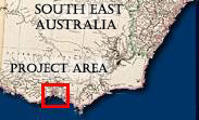
After locating the wreck of the Aniuera, mapping a portion of it, and finding the right location to search for the wreck Mountain Maid, we moved on to the Portarlington Jetty project. The night before this project started, we took the undergrads (team “whatever name they thought was funny for the day”) by the hand like a guiding parent, spoon-fed them the methodology for mapping the Aniuera, and let them out without the training wheels.

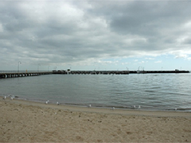
Figure 1 - Portarlington jetty VIC. (photo courtesy of the Maritime Archaeology Program at Flinders University).
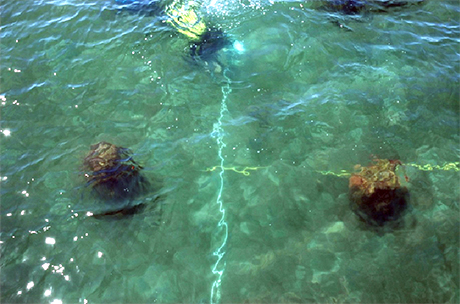
Our objective for the Portarlington jetty was to map the existing jetty, and conduct a pre-disturbance survey and map of the archaeological remains of the old jetty underwater. We sent Ben (Picasso) Holthof out to mud-map the existing structure, then spent almost two days shooting in all the land points with a total station (when it worked). Under the careful watch of our supervisors: who either sat on shore drinking or buying us coffee and listening to Shakira (Peta and Jun); or sat on the bottom reading a book (Mark); we spent about 6 hours in the bloody cold water shooting in the entire old jetty remains with a crazy 3 metre range-pole contraption held together with duct tape and an elaborate system of a man in scuba, a man snorkelling, a man on the jetty with a radio, and a man running the total station. As a backup to the total station we also conducted a baseline offset survey of the old remains. Our evenings were spent ‘hydrating’, plotting up our data, and getting prepared for the next day.

Figure 2 - Station Survey (from left to right): Darren Kipping sighting on base unit, Ben Holthof holding target prism (photo courtesy of the Maritime Archaeology Program at Flinders University).
The majority of our time was spent on PR work though, with most passing members of the public interested in what we were doing; some with useful historical insights and information, others...less so. Comments ranged from telling us where the jetty used to be with interesting facts about the old rail line and construction dates, to asking us in all seriousness whether the Egyptians built the old jetty.
With all of the data gathered both on land and underwater, we have begun the arduous process of compiling a site plan and report. Using freehand and computer drawing techniques, we have a plan that thankfully resembles the actual jetty and the piles underwater. Fortunately all the real work has been done for this site, because tomorrow the undergrads will be unleashed upon Portarlington Jetty to follow in our wake...once again...probably counting starfish.

Figure 3 - Baseline Offset Survey: Matt Harder measuring part of the old jetty (photo courtesy of the Maritime Archaeology Program at Flinders University).
Comments, questions, or suggestions?
For field school related issues please contact: mark.staniforth@flinders.edu.au
For website related issues please contact:
mua@keimaps.com
Return to Project Journal home page.

