East Carolina University 2007 Field School
in Underwater Archaeology
15 June 2007
By Melissa Ashmore
Well, today was the last day of our time in New Bern. Although we spent an entire week doing remote sensing and ground truthing in the area, we had previously found only logs and sand bars. But yesterday we finally had a good solid hit on our side scan sonar that looked to be a ship. When we ground truthed it, we were finally rewarded…with a steel barge that is over 140 feet long. It’s a large ship that was grounded on the bank of the Trent River. The measurements we took extended from one end, which was out of the mud, to the other that disappeared into the mud as far down as Adam could reach and still kept going. In the same area we also found what felt like railroad track (long pieces of metal I-beam) and other debris. We had a wonderful picture of it from the sonar, but in a cruel twist of fate that none of us will forgive any time soon, the entire computer shut down and the three hours of work that had been done that morning were lost. So our goal today was to go back over the site and get another sonar picture of it. We also needed to fill in some of the gaps that we had from our survey of the Neuse River. We did all of this waiting for our inverter to fail at any time. We have had many, many problems with our gear this entire week and the main one was that the inverter will not recharge the batteries as it was supposed to. Because of this, we had a limited time that the equipment could be run before the whole system shut down. We succeeded in our task today however, and Calvin lost our bet on when the batteries would fail.

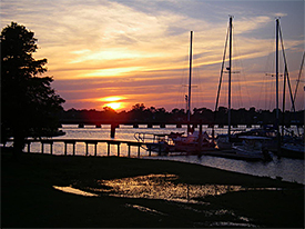
The sunset view from our hotel, the Bridge Point. (large view)
Last night we were invited to the New Bern Yacht Club for a barbeque. It was a wonderful time, and we got to talk to some very interesting people. It was very rewarding because the entire group was so interested in what we were doing. I had a few long conversations, explaining exactly what we were doing and finding, and was impressed with the volume of questions I was able to successfully answer. It made me appreciate how much information I have actually absorbed in the last few weeks. After we ate, Larry gave a short presentation about the things we had found and some of the history of the area. After (and during) the speech, the members of the community asked many questions and offered some insight about the area. For example, the long I-beams that I had felt may well have been a railroad. One of the yacht club members remembers there having been a railroad there at some point.
There was another man who claimed to have pictures of a vessel near the dolphins (large pilings, usually several logs, bound together to provide a firm tying place for boats) in the middle of the Neuse River. He said that he took the pictures during a blowout and had seen the frames above the water. Unfortunately, the pictures were lost when he accidentally dropped his camera overboard. Local knowledge of this type is one of the most important aspects in archaeological research of an area. Many of these vessels may never be found in the documented history of the region, and it is only by asking the locals that these vessels can be located. While these accounts must be taken with a grain of salt, often the experience of the residents of an area gives the most accurate information available on the current location of archaeological sites. This information should never be fully dismissed as it might contain important clues, even if it is not entirely accurate. This is just one of the many things I have learned over this field school. Another being that it can get really cold in June. I don’t think it got over 70 degrees today, and on the water, especially if you’re wet from diving and with the wind blowing, that’s really cold.

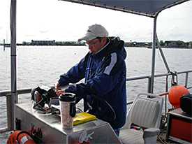
Dr. Stewart bundled up against the unnatural cold of Friday.
While we were in New Bern, we became small time celebrities. We had a front page story in the newspaper (a picture of Adam and I discussing a piece of log we had just found while diving that brought to mind an old fisherman telling a story of ‘it was this big!’), Larry and Jeremy on a morning tv show talking about our project, and two local evening news spots. When we were pulling the boats out of the water this afternoon at the boat dock, we had several people come up and ask if we were part of the archaeology crew. We would smile sheepishly and admit it and then would answer questions until they ran out, interrupted only by our work of getting the boats on the trailers. I was impressed by the fact that they all knew who we were, one man even calling me by name, having recognized me from my picture in the paper. It was an interesting experience.

A reporter talking to Crew Chief Michelle Damian about what we had been finding.
But alas, now that we have left New Bern there is no more fame, and the remainder of the field school will be spent in clean up (including the boats and equipment). We will also finish our drawings of the artifacts we found in Washington Park, and will work on our site map of the Kickin’ Bitch. To this site plan we will add profiles of both the bow and stern and several cross sections of the amidships portions of the wreck. This site map will then be inked onto a large mylar sheet and stored with the other information from the site, to be available for anyone doing research on it in the future.
Please feel free to contact us at mua@keimaps.com with any comments, questions, or suggestions during the weeks to come.
Return to Project Journal home page.

