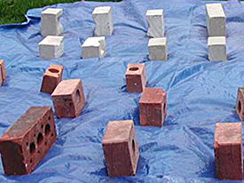
Tracer brick production 2004: Before.
Initial work by the author on the Hazardous site began in 2002. In this instance, the output of research was a Master of Science degree dissertation entitled: Warship Hazardous Prize: Analysis of the Material Culture and Dynamic Environment of an Eroding Shipwreck. Within the scope of this project, initial mapping work in an earlier version of Site Recorder 4 was undertaken and the potential of the tracer study began to blossom. The primary intentions of the MSc project was to develop artefact distribution maps of the site based on location data spanning the years 1986 through 1999, allowing for detailed spatial analysis to be conducted, and for observations about the site’s current environmental conditions and viability as a research tool to be assessed and integrated with the artefact distribution maps. The intentions of the subsequent PhD project is to take this initial work one step further and to develop and assess a methodology suitable for the re-investigation of such sites and the primary documentation of newly identified sites.
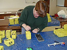
Tracer brick production 2004: During.
The desire to study the dynamic nature of the environment found at the Hazardous site has led to the development of an experiment that would study the how tracer artefacts move across the site during a single season, as well as potentially across subsequent seasons. Bricks donated by Iain Grant, the current licensee of the wreck, were used as tracer artefacts in this experiment. Two different types of bricks were obtained and were then cut into 3 or 4 different sizes, depending upon the brick type. The first type of brick was very dense, white grained engineering brick. The second type of brick was standard, red architectural bricks with pre-drilled holes. Sizes of the white bricks include, whole, half cut and one-third cut bricks. Sizes of the red bricks include whole, half cut, one-third cut and a small sample of one-quarter cut bricks.
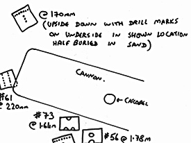
First set of measurements after 2 months on the seabed. (View Large Image)
All bricks were painted a bright yellow colour for ease in identification on the seabed. After painting, all bricks were weighed, measured, and tagged for identification. In the case of the red bricks, tagging was done using bright yellow electrical tape tags labelled with symbols cut into the tape and yellow cable ties through the pre-drilled holes holding the tags in place. These tags were pulled close and extra lengths of cable tie were cut off to eliminate the chances of the tags themselves causing any additional drag to the movement of the bricks. In the case of the white bricks, a series of shallowly drilled holes was used as a symbolic labelling system that will be able to felt underwater. It is assumed that a moderate level of marine growth across the bricks will occur which is why symbolic systems of labelling that could be easily determined by touch rather than sight have been adopted. Additionally, a back-up system of numbers painted directly onto the bricks has also been utilized in the event that previously mentioned labelling systems proved unsuccessful.
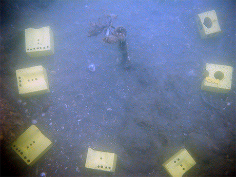
Tracer brick placement 2004: Initial Seabed Placement.
In the summer of 2004, a selection of 60 bricks, 30 of each brick type and an equal representation of cut sizes, were placed on the seabed across the site. These bricks were placed in clusters of 10 at 6 permanent datum points located around the site, in areas of both stability and in areas of regularly mobile sediments. During the course of subsequent field seasons through 2004, 2005, 2006, these bricks were monitored as closely as possible to track their movements. Measurements were taken to track the movement of the bricks during the course of as many dive weekends as environmental conditions across the site would allow. Some seasons this access was severely limited due to poor dive conditions on site. Because each brick has a individual identifier, it has been possible to track whether or not type, size, or weight impact the movement across the seabed.
Introduction Post | Tracer Study Post Part 1
Return to In The Field home page.
This research was conducted with assistance from:
Iain Grant, licensee of the Hazardous shipwreck site, divers from the The Hazardous Project Team and divers from the 308 Sub-Aqua Club.
Hampshire and Wight Trust for Maritime Archaeology: http://www.hwtma.org.uk/
English Heritage Maritime: http://www.english-heritage.org.uk/server/show/nav.1276
Comments, suggestions, or questions can be directed to sarahelizabethholland@gmail.com


