
- MUA Home
- All Project Journals
-
- Introduction
- 24 July 2007
- 27 July 2007
- 8 Aug 2007
- 28 Aug 2007
- 17 Sept 2007
- 26 Feb 2008
- 19 Mar 2008
- 27 May 2008
- 5 June 2008
- 23 June 2008
- 25 June 2008
- 12 Aug 2008
- 23 Aug 2009 NEW
- 10 Sept 2009 NEW
-
- About the Author
- Acknowledgments
- Ford Interview
-
- The top banner is a portion of a circa 1772 map of Lake Ontario by Thomas Kitchin. While beautifully engraved, the map, like most of the period, is grossly inaccurate. However, it does offer insight into the place names and significant locations of eighteenth century Lake Ontario. Archives of Ontario C-87-01.
Click here to view map.

The Lake Ontario Maritime Cultural
Landscape Project
23 July 2007
By Ben Ford
Project Introduction
What lies between terrestrial and submerged archaeology? The archeology of the shore. Why study the shore? In order to understand how people and goods moved from land to water and back again and to give us a better understanding of human history.
While there are plenty of well-studied shipwrecks and our grasp of terrestrial archaeology is strong, archaeologists have not invested a significant amount of effort into connecting the two sub-fields. Many people in the past, however, transitioned easily from one medium to the next and many of the artifacts that we excavate likely moved across a waterline sometime before being deposited. The Lake Ontario Maritime Landscape Project will address this interface by focusing on how people interacted with the water along Lake Ontario’s shoreline between 5000 years before present (BP) and 1900. With a little luck, we will be able to identify what people were doing where along the shore and identify how these activities related to the environment.

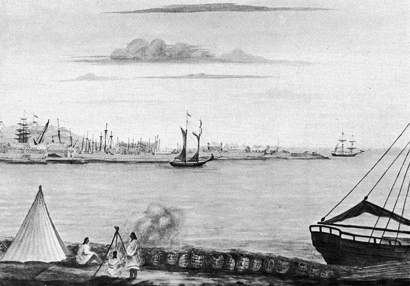
Dockyard and fort at Kingston, Ontario circa 1813 looking across the Cataraqui River from the town. (large view)
As a Ph.D. candidate at Texas A&M University, I have been trained as a nautical archaeologist, but I hope to bring my prior background as a terrestrial archaeologist to bear on this project in order to develop a more holistic picture of human interaction with the water. In general, I am far more interested in sites than artifacts. I love artifacts for their visceral connection with the past and the information that they hold, but the questions that interest me revolve around how people arranged themselves on the landscape, how they used spaces, and how they were influenced by their environments- physical, cultural, political, and psychological.
A study of the shoreline is an extension of that interest and Lake Ontario is a natural laboratory in which to address these questions. It is largely segregated from the other Great Lakes, first by Niagara Falls, and later by the restrictions of the Welland Canal. Thus, the lake is a reasonable sample with outside influences but no overwhelming ones. The shores of Lake Ontario also contain extensive evidence of Native American occupation and early remains of European American incursions. In particular, the portion of the lake near the St. Lawrence River, where the fieldwork for this project will take place, witnessed the earliest major French movement into the Great Lakes in 1673 and some of the earliest mass settlement of the area by the British a little more than a century later. Furthermore, this portion of the lake shore is more protected and less developed than much of the shoreline, offering better opportunities for finding preserved archaeological sites.

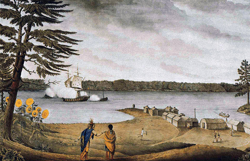
Fort Galet at the present site of Ogdensburg, NY, depicting the capture of a French warship in 1760. (large view)
Through the next several journal entries, I will trace the development of this project as we conduct off-shore remote sensing, dive on targets and in the shallows, interview property owners, and walk their property. The project will continue through next summer with final analysis winding down by winter 2008. I will continue to post updates as we conduct the survey, analyze the data, and synthesize our results with the existing archaeological database. Hopefully, there will be plenty of entertaining and interesting stories and discoveries to relate.
Please, feel free to contact me with questions and suggestions ben.ford@iup.edu. The learning curve will be steep over the next few months. To the best of my knowledge, there is no manual on conducting this sort of survey and I expect to make mistakes. I welcome thoughts on better ways to conduct this research. Besides, if I can't explain my methods to this audience, I will be hard-pressed to justify them to my committee. Furthermore, I believe that archaeology, like all science, benefits from transparency. I'd rather have a clear description of the process than to collect a series of anecdotes, shake them around in a black box (in this case, GIS), and spew them out with no outside involvement.
So wish me luck, and check back soon for more updates.
Return to Project Journal home page.