

- MUA Home
- All Project Journals
-
- Introduction
- 24 July 2007
- 27 July 2007
- 8 Aug 2007
- 28 Aug 2007
- 17 Sept 2007
- 26 Feb 2008
- 19 Mar 2008
- 27 May 2008
- 5 June 2008
- 23 June 2008
- 25 June 2008
- 12 Aug 2008
- 23 Aug 2009 NEW
- 10 Sept 2009 NEW
-
- About the Author
- Acknowledgments
- Ford Interview
-
- The top banner is a portion of a circa 1772 map of Lake Ontario by Thomas Kitchin. While beautifully engraved, the map, like most of the period, is grossly inaccurate. However, it does offer insight into the place names and significant locations of eighteenth century Lake Ontario. Archives of Ontario C-87-01.
Click here to view map.

The Lake Ontario Maritime Cultural
Landscape Project
28 August 2007
By Ben Ford
The field season is almost over; all of the crew has left and I have only a few days to wrap up some archival research before returning to Texas. Before leaving New York, however, I wanted to update the journal with the final aspect of our fieldwork: the diving. Over the past three weeks we conducted 145 dives totaling more than 80 hours of water time. These dives were split between two activities: shoreline swimming surveys and target inspections.
The shoreline swimming surveys were conducted in areas where the water was too shallow to tow the remote sensing gear. These surveys also constituted the underwater equivalent of a pedestrian survey, allowing archaeologists to search the region immediately offshore for small artifacts and features. Swimming along transects spaced five to eight meters apart, divers, wearing either SCUBA equipment or snorkels, inspected the area from the waterline to 30–50 meters offshore. Variability in depth and visibility dictated the specifics of each survey. For example, in areas where the water was shallow and clear, the archaeologists were able to snorkel. These areas also required the archaeologists to swim a greater distance offshore to overlap with the remote sensing survey areas. Deep or turbid water, alternatively, required archaeologists to swim closer to the bottom wearing SCUBA gear.

Archaeologist taking a compass bearing for a shore swimming transect. (large view)
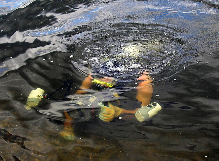
The target inspections were conducted from our inflatable boat. The boat would be piloted to within 20 meters of a target using the Geometrics MagLog program for navigation. Once on-site we cut the engine and dropped anchor (occasionally using a cinderblock when working over exposed bedrock). As we completed more inspection, the pilots got better at compensating for the GPS lag, current, and wind, so that on a calm day the diver was often within five meters of the target. Once the boat was stopped the diver would roll backwards into the water and swim to the approximate location of the target using a tape and compass to reference their location to the GPS receiver. After descending the diver would conduct an expanding square search until the target was identified or the square reached approximately 20 meters. The sides of the square were increased every two turns by four kicks (approximately three to six meters, depending on the diver) and most dives lasted 15 minutes. The majority of the target inspections focused on side-scan sonar targets and consequently we were able to identify most of the targets. However, we also dived on concentrations of magnetometer anomalies. Some of these anomalies were identifiable. However, many seem to be buried.

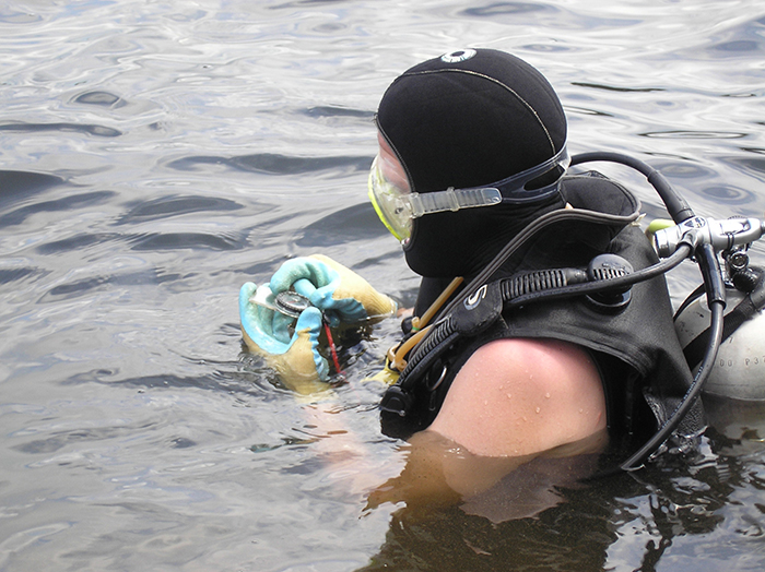
Archaeologist Michael Quennoz returning to shore after photographing an artifact. (large view)
All significant artifacts and features discovered through the swimming survey or identified during the target inspections were measured and drawn on mylar drafting film and in most cases photographed using a camera with underwater housing. Using this method the resources could be recorded and described on the spot rather than relying on diver memory. No artifacts were collected. The location of each resource was also recorded using GPS. The targets were easy because they were already associated with geographic coordinates. For objects identified during the swimming survey, a tape and compass were used to input offsets to a shore based GPS receiver.
So what did we find? Far more rocks, weeds, and trees than I would have liked. In general, the artifacts and features that we identified reflected the diversity that I expected, but not the density that I hoped for. It was also evident that we got better at piloting the boat and selecting targets as the project progressed, since the clarity of the records and the quality of the selected targets both increased in the later survey areas. However, there were a number of good finds in at least two of the areas that we surveyed. In the Long Carrying Place vicinity we identified a timber stick lost from a raft, which when combined with the pre-Contact sites, portage route, hay dock, boat yard, blacksmith shop, log cabin, and other resources known in the area argues for a very active maritime landscape. In the Storrs Harbor area we discovered a likely ballast pile (possibly from a ship preparing to take on cargo), a dock crib, an anchor, an ice spud, and a number of yet-unidentified iron objects. Possibly the most significant find from this area is still a mystery. A War of 1812 gunboat was lost in a portion of the survey area where we recorded some strong magnetic anomalies; however, the boat was not visible and may be buried in a sandbar. We are working with historian Gary Gibson and archaeologist Tim Abel to identify the wreck location, but it will be several more weeks before I have an opportunity to correlate the historic maps and magnetometer data and decide if the area is worth pursuing.

Long Carrying Place. The stone spit in the foreground are the remains of a 19th century hay dock, and the pre-Contact Crouse Site dominates the background. (large view)
In the coming weeks I will update the journal with the lessons we learned this season and the preliminary results of the analysis, but in the meantime I need to finish cleaning the rental property and packing the trailer.
Please feel free to contact Ben at ben.ford@iup.edu with any comments, questions, or suggestions during the weeks to come.
Return to Project Journal home page.