
- MUA Home
- All Project Journals
-
- Introduction
- Survey
- Shallow Water
- Tanapag Lagoon
- Garapan Lagoon
- Tanks A Lot
- Plane Wreckage
- Side Scan Sonar
- Garapan Lagoon2
- Wrap Up
-
- Crew Page
- Share Your Story
- Links
- Survey Video
- New Article
- 19 June 08 Article
- 3 May 08 Article
-
- The top banner of this page is a composite made from two photographs. The background photo is of the USS North Carolina operating off Saipan in June 1944. The second photo shows Lt. R.S. Selby shooting the sun from USS Castle Rock, April 1945 taken at Saipan. (Both photos courtesy US Naval Historical Center)


Underwater Archaeology Invasion Beaches Survey 2008
20-21 April 2008
By Jason Burns and
Michael Krivor
Surveys in Shallow Water

Brady Barrineau spotting coral heads on the bow of the survey vessel.
We are often asked how we survey in such shallow water. Our answer of course is always very carefully. In Tanapag Lagoon, the entire area is covered in large brain coral heads that remind you of picking your way through a mine field. To systematically survey in such shallow water the vessel travels very slowly, with a lookout on the bow to make sure we do not ground out. There are some areas though where we just can't safely navigate. We will study our coverage maps and begin to fill in the areas to ensure complete coverage of Tanapag Lagoon.

Coral heads throughout Tanapag Lagoon. (Large View)
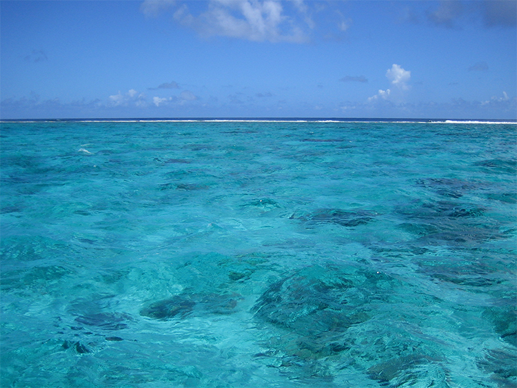
Outside Garapan Lagoon
The survey has moved to outside the reef line of Garapan Lagoon in the heart of the Invasion Beaches. Several areas have the potential to hold tanks and landing craft lost during the invasion. The reef line is very broad and flat in this area and you can see why they chose this area of Saipan for the landings. Once we analyze the data we will report back on the potential findings.

Broad, flat reef outside of Garapan Lagoon.
Please feel free to contact us with your comments, questions, or suggestions. You can reach Jason Burns at jason@searchinc.com and Michael Krivor at michael@searchinc.com . Questions related to the MUA website can be sent to mua@keimaps.com.
Return to Project Journal home page.