


The primary study site for this ongoing PhD project is the warship Hazardous. Originally built as a French third rate ship of the line in 1698, Le Hazardeux (the original French name) was constructed of oak and pine. The ship was 137-feet long with a 38-foot beam at the mid-section. For the following five years, the ship served as a member of the French Royal Navy.

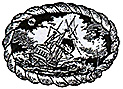
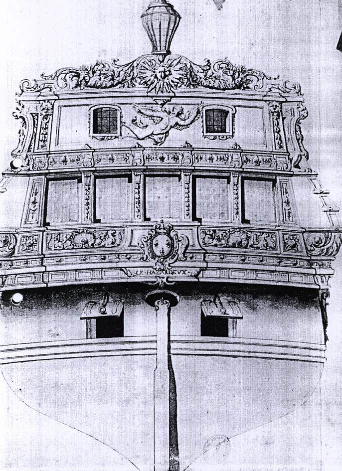
A contemporary print from the Musee de la Marine in Paris shows the stern section of the Hazardous (as evidenced by the just visible French name) exhibiting an ornate design perhaps in honour of the 'Sun King', Louis XIV. Large View
In November 1703, under the command of Captain de la Rue, it was misguidedly sailed by its captain into the English Channel and promptly seen by three warships of the English Channel Squadron that engaged Le Hazardeux in battle. By the time the French struck their colours and surrendered the ship, Le Hazardeux was, according to a contemporary account, ‘reduced to a perfect wreck’ (Owens 1988a:285). At that time, the ship was towed into Portsmouth Harbour as a war prize with serious damage inflicted to her overall structure. During the following six months, the ship was extensively rebuilt and re-gunned. The name was maintained but adapted by the English to the warship Hazardous Prize. When the ship was commissioned into the English Royal Navy on 27 March 1704, it was done so as a fourth rate ship of the line with a crew of 320 men and 54 guns and with an increased displacement of 875 tons.
The Hazardous was not long in the service of the English Royal Navy despite impressive armament and its newly rebuilt status. In November 1706, the ship was travelling in convoy, with three other man-of-war ships including warship Advice, on a trip to escort a fleet of 200 merchant vessels. The warship Hazardous, commanded by Lt. Hares, was to end the voyage at the Downs off Kent (Owen 1988a:286).

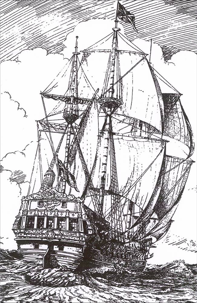
Artist's rendering of the warship Hazardous under sail. Drawn in 1990. Large View
Early in November 1706, weather prevented the precise course that had been intended for a convoy with three other man-of-war ships on a trip to escort a fleet of 200 merchant vessels from Chesapeake Bay Virginia back to England. Captain Lowen, commanding officer of the convoy vessel warship Advice, decided to push forward down the English Channel despite the weather, being low on provisions, and having sick crew members. In an attempt to make for a safe nearby naval anchorage as winds increased to gale strength, the Advice signalled the Hazardous to make for St. Helens Roads on the eastern side of the Isle of Wight. However, the Advice failed to signal to the Hazardous that they were close to shoal waters. The Hazardous, while trying to follow the lights of the Advice, was driven into the shoals by the winds and forced to seek a way to anchor in an attempt to prevent grounding and extensive damage to the ships’ hull. By the evening, anchoring had not been successful and the ship was irretrievably grounded and being pushed further in towards the shoreline, continuing to strike the bottom throughout the night (Owen 1988a:286). The following morning, Lt. Hares had no option but to follow the direction of wind and current. He cut away the main and mizzen masts and severed the anchor warps and pushed the ship as far into land as possible to save what he could of the ship, guns and crew.
After an account of salvage in 1715, no further account of the ship has yet been found and it can be assumed that its state as a wreck began to settle into past memory and local mythology. The initial grounding on the reef in 1706 broke the back of the ship at the mid-section, an area that continues to be a vulnerable point in the site. The bow section quickly settled into the silt on the shore side of the reef causing the stem and port side to be fairly well preserved by sand combined with the weight of the guns. The stern settled into a protected corner of the reef weighed down by the guns in a way similar to the port side (Fenwick and Gale 1998:134-135). Thus, the Hazardous began its transformation from shipwreck into archaeological site.

Approximate location of the site off the south coast of England (Courtesy of Google Maps). Large View
The wreck site was quite accidentally located in 1977 by sport divers. The interest and work of the #308 branch of the British Sub-Aqua Club (BSAC) led to the wreck becoming designated under the Protection of Wrecks Act 1973. The group was granted a survey license and began to investigate the site in earnest during the mid-1980s (Owen 1988a:285, 287).
During the late 1980s, numerous individual artefacts and large concretions were raised and examined and the in situ cannon were surveyed. It was noted during this period of research that erosion patterns were shifting on the site and that this was exposing timbers, concretions, and artefacts that had not previously been visible. For this reason, regular monitoring of the site was deemed necessary and has been conducted ever since. Given the excellent condition of recently exposed timbers, it was thought at the time that the seabed levels had remained relatively stable from the time of wrecking until the early 1980s (Owen 1991a:331).
In 1998, the Hampshire and Wight Trust for Maritime Archaeology (HWTMA) became the newest in a continuing line of archaeological advisors. Since that time, annual survey work and investigation has taken place under their direction and advice. Their survey and monitoring work has focused primarily on the amidships section of the wreck where the most intensive erosion continues to take place. This has included the removal and analysis of numerous concretions from this dynamic area of the wreck.

1991 Site plan showing location of the shipwreck within a partially sheltered reef/outcrop (Owen 1991b:1).
In the next post we will look at how modern painted bricks are being used to learn about the movement of artefacts on historic shipwrecks.
Introduction Post | Tracer Study Post Part 2
Return to In The Field home page.
This research was conducted with assistance from:

Iain Grant, licensee of the Hazardous shipwreck site, divers from the The Hazardous Project Team and divers from the 308 Sub-Aqua Club.
Hampshire and Wight Trust for Maritime Archaeology: http://www.hwtma.org.uk/
English Heritage Maritime: http://www.english-heritage.org.uk/server/show/nav.1276
Comments, suggestions, or questions can be directed to sarahelizabethholland@gmail.com